

HERE & NSW Rural Fire Service expand fire trail routing
Thu, 20th Aug 2026
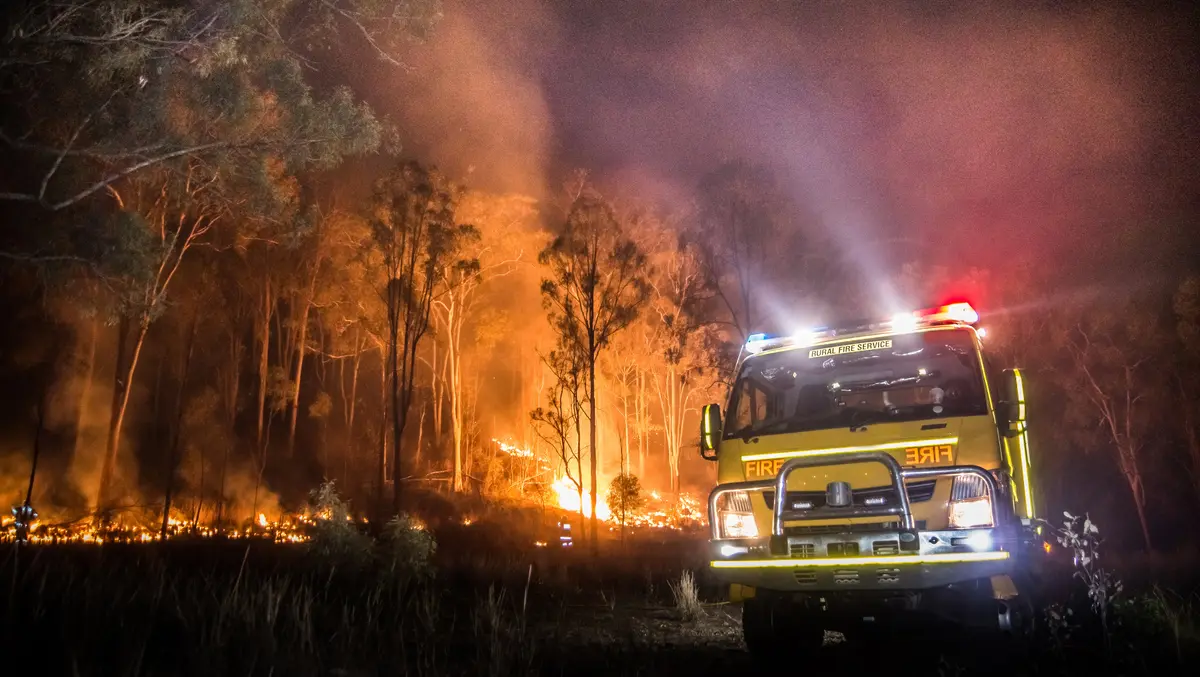
HERE Technologies and the New South Wales Rural Fire Service have expanded emergency response routing across remote fire trails in the state, adding more than 60,000km of fire trail network to a routable map used in operations.
The project combines HERE's road network data with operational mapping from the New South Wales Rural Fire Service to create a single route-guidance network. It includes fire trails, private roads and other off-road access routes used by crews responding to incidents beyond the public road system.
The New South Wales Rural Fire Service covers about 95% of the state and responds to thousands of incidents each year, including bushfires, grass fires, storms, search-and-rescue operations and vehicle accidents. In many cases, crews must reach locations via tracks and trails that standard navigation products do not fully capture.
The mapping has been integrated into Computer Aided Dispatch and Mobile Data Terminals, allowing dispatchers and field crews to use the added routes in day-to-day navigation and incident response.
Off-road gaps
Emergency services have long relied on a mix of public mapping, local knowledge and agency-specific datasets to reach remote areas. Fire trails and private access roads can change over time and are often harder to keep navigation-ready than public roads, creating gaps for agencies that need dependable route guidance in difficult terrain.
The new network is intended to give the service a broader view of navigable routes across New South Wales, on road and off road. It also supports vehicle-specific navigation for fire appliances, which may require routing that reflects operational needs rather than standard consumer travel patterns.
Daniel Antonello, General Manager, Oceania, HERE Technologies, said accurate mapping is central to emergency operations.
"Emergency response depends on having the most accurate picture of the landscape possible," Antonello said.
He said many routes used by frontline agencies fall outside conventional road networks.
"Many of the routes used by emergency services every day are not conventional roads. By combining HERE's AI-powered location technology with NSW RFS' operational intelligence, we're helping create a more complete and actionable view of the road and trail network, enabling responders to search, locate and respond with greater confidence when every second counts," Antonello said.
Digital systems
The work forms part of a wider digital overhaul at the New South Wales Rural Fire Service. The enhanced map supports its dispatch systems, in-vehicle terminals and navigation tools used by fire appliances in the field.
For agencies covering large rural and regional areas, route quality can directly affect response times, crew safety and access planning. A more complete map can also help incident managers during preparation and recovery, not just active response.
Matthew White, Acting Director, ICT and Chief Information Officer at the Rural Fire Service, said fire trails remain essential to operations across the state.
"Fire trails are a critical part of how we access and manage incidents across New South Wales," White said.
He said the combined dataset gives crews a stronger operational picture.
"By bringing together our operational knowledge with HERE's mapping technology, we're building a richer and more comprehensive representation of the access network our crews rely on every day. This helps improve situational awareness and supports more informed decision-making in the field," White said.
The New South Wales Rural Fire Service is the world's largest volunteer fire service, with more than 68,000 volunteers. Its operating area includes remote and challenging landscapes where access routes may sit outside the public road network used by most commercial navigation systems.
Keeping those datasets current will be important if the map is to remain useful during emergencies, particularly where access can be affected by fire conditions, weather or land management changes. The project reflects a broader shift among emergency services towards combining internal operational data with commercial mapping platforms to build more complete routing systems for frontline crews.
The result is a unified routable network that supports planning, preparation, response and recovery across New South Wales.